| Airspace Technologies Ltd co. has different systems of earth remote sensing. It permits to carry out quickly and precisely any kind of jobs related with this technology.
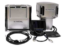
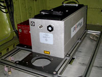
In 2008 we purchased the airborne digital wide camera UltraCam X from Microsoft. This camera has one of the best image characteristic and easy data processing in its class. These factors aid to reach higher quality and efficiency in data processing.
The airborne digital wide camera «UltraCam X» provides new opportunities during airborne mapping and allows creating high quality products for lowest prices. |
|
Airborne digital wide camera
UltraCam X |
|
 |
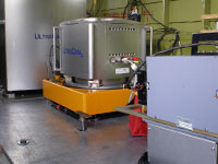
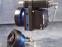
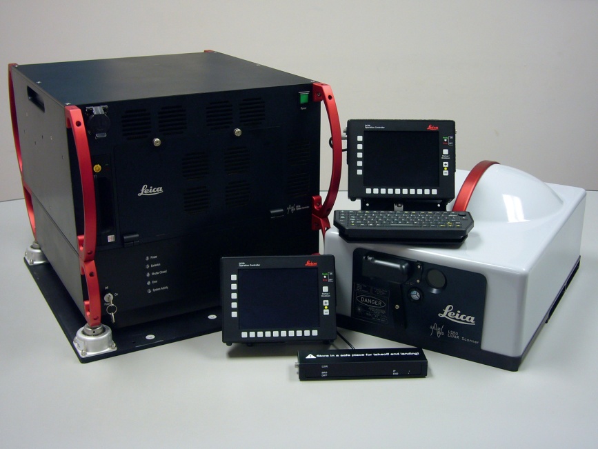
Recently Airspace Technologies Ltd co. purchased newest airborne lidar Riegel LMS –Q560, the only one in Russia as for today. Uniqueness of this scanning system consists in the possibility of a detailed study of scanned layout by online waveform digitization of reflected signal during survey and its further analysis. |
|
Airborne LIDAR
Riegel LMS - Q 560 |
|
System advantages:
-
Analysis of surface reflected waveform;
-
Generation of high frequency signal ( up to 240 kHz);
-
High accuracy ranging( up to 20 mm);
-
Easy to use interface ;
-
Absolute safety at any airborne mapping high;
-
Homogenous reflected laser point distribution;
-
Large operation temperature range.
|
|
|
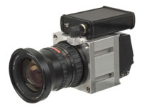
Digital airborne camera
Rollei |
|
We use the digital aerial photo camera Rollei for airborne mapping support. Thanks to its easy handling and compactness, this camera provides high quality photography of scanned territory that can be used in orthophotoplan generation |
|
|
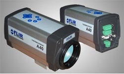
IR camera
ThermoVision A40 |
| In 2008, Airspace Technologies Ltd co. purchased IR camera ThermoVision A40, produced by FLIR systems, one of the leading companies in this sector.
FLIR systems are one of the most recognized world leaders in thermo vision technology. Its products are used in different field, from technical forecast and safety tasks till scientific research and medical diagnostic.
ThermoVision A40 is a strong infrared solid camera intended for high quality infrared image capture. It has high sensitivity and provides high quality infrared images. ThermoVision A40 enables to show 0.08 0C temperature difference within temperatures from -40 0C up to + 500 0C.
Some of ThermoVision A40 advantages are:
-
Integrated alarm function
-
High quality IR image (320x240 pixels)
-
Very high temperature sensitivity
-
Non cooled long-wave bolometric sensor
-
Strong and solid construction
-
Integrated focusing electromotor / autofocus
Easy handling interface permits matching with other complex equipments ThermoVision A40 permits contactless temperature measurement and high quality image capture.
Инженерно-геологическая лаборатория
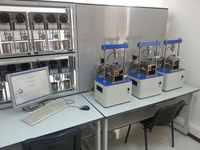
Ltd. "AeroTech" has at its disposal engineering and geological laboratory which allows the following types of work:
Identifying indicators of properties, composition and soil conditions for their classification in order to allocate by them on the studied areas rock types with the same physical and mechanical properties;
quantification of plasticity, fluidity, strength, deformability, and other characteristics of rocks in order to use them in the design of various engineering structures, forecast possible changes in these properties under the influence of structural design, as well as the risk assessment of these changes on the stability of engineering structures;
the study of corrosion activity and chemical composition of soil and groundwater to forecast occurrence of chemical interactions within nature - man-made environment in the establishment and operation of engineering structures.
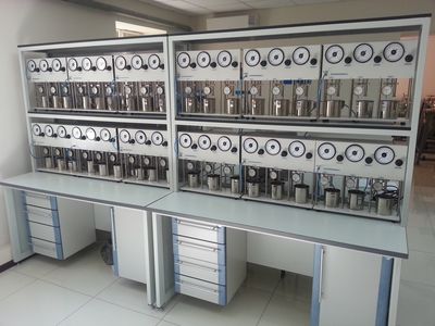
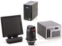
Measuring and computing systems ASIS - is an automated multi-functional complexes intended for laboratory testing unfrozen and frozen soils and rocks to determine their strength and deformation properties. ASIS complexes represent a set of functionally integrated mechanical devices (appliances), the measuring system and the software's CPI "ASIS".
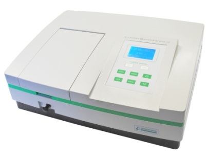
PE-5400V spectrophotometer is used to control the composition of the water, soil, air and environmental hygiene studies and in the analysis of raw materials, finished products, metals and alloys, chemical products, etc. The device included in the State Register of measuring a № 41144-09
Set TEST-K2M
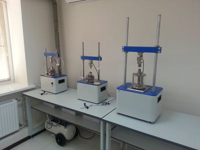
Set TEST-K2M is designed to probe the non-frozen sandy and clay soils under GOST 19912-2001 for a comprehensive assessment of the physical and mechanical properties of soils under c SP 11-105-97, and the bearing capacity of piles in SP 24.13330.2011 "SNIP 2.02.03-85 pile foundations, "SP-50-102-2003" Design and Installation of pile foundations "and MGSN 2.07-01" Moscow city building codes. The bases, foundations and underground structures. "
Test set-K2M can be used as an accessory to the geological drilling rigs, providing the force on the slaughter of at least 30kN, or in special units probed.
|
|
|
|
|
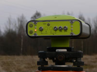
Leica ALS 50-II
Leica ALS 50-II high-precision airborne laser scanner. The scanner can be operated at high altitudes surveying while ensuring high precision laser data. Supports Multi Pulse In Air (MPIA) providing simultaneous presence in the air 2-laser pulses, which increases system performance by half.
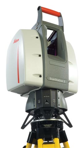
Leica ScanStation 2
Terrestrial Laser Scanner Leica ScanStation 2 is designed to perform ground-based laser scanning and create highly accurate three-dimensional models of industrial facilities , topographical surveys and executive of various scales .
Speed ??increasing up to 50,000 measurements per second , wide scanning area of 360 x 270 degrees and the accuracy comparable to the errors of the total station , lifts laser scanning technology to the next level . The software used Leica Cyclone allows you to model the most complex design and create any material depending on the customer - from the textured three-dimensional model to a standard drawing , issued in accordance with regulatory and technical documentation.
Universal navigation and aerial mapping control system Standard CCNS4 is used during airborne mapping and creation of flight plans. CCNS4 provides high reliability and convenience. Practically, it can be used with any kind of digital and analogous cameras and virtually permits full automation of aerial mapping process. |
|
Navigation and aerial mapping control system
Standard CCNS4 |
|
Supported GPS receivers:
-
Internal Trimble 6/8-channels. GPS receiver L1
-
Internal Ashtech 12-channels. GPS receiver L1 (G12)
-
Z-Xtreme, external 12- channels. GPS receiver L1/L2
-
External GPS receiver with NMEA 0183 data format
-
Aircraft differential GPS (protocol RTCM 104)
-
OmniSTAR 3000L external module
-
OmniSTAR internal module
Supported cameras and sensors:
-
Wild/Leica: RC10, RC10A, RC20, RC30
-
Carl Zeiss Jena: LMK, LMK 1000, LMK 2000
-
Zeiss Oberkochen, Z/I Imaging: RMK-A, RMK-TOP
-
OSAKA OPTICAL LTD., О saka : HIEI SE-II Photo System
-
Zenit, Moscow: A-84 mil. PAN camera
-
Sc Laser scanner, for instance, Daedalus
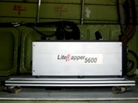
-
Laser scanner, for instance, LiteMapper, ALTM, TopoSys
-
Magnitometry and gravimetry aerial mapping systems
-
Vision systems
Digital cameras, for instance, DigiCAM, Vexcel UltraCamD, UltraCamX. |
|
|
|
In addition, Airspace Technologies Ltd co. has all necessary equipment for supporting airborne mapping and geodesic surveys: tachometer, GPS receivers, automobiles, etc.
|
|
Digital airborne camera RCD 30
Digital airborne camera RCD 30 is a new medium format camera for photogrammetric applications. Camera makes imaging in frame mode. Used for large-scale topographic mapping of area and line objects in the survey, design, construction, digital maps and plans.
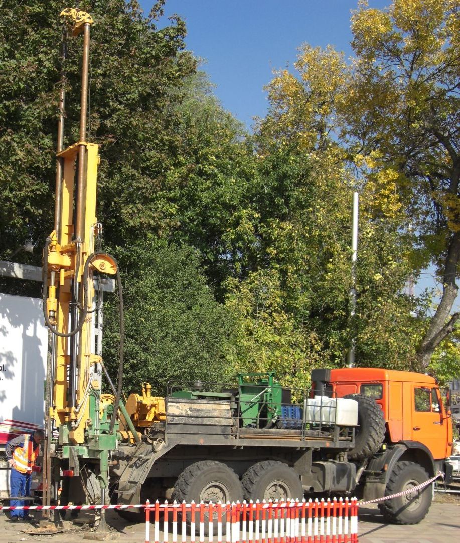
Drilling rig UBSHM-1-20 based on GAZ 340039-22
Compact unit for drilling UBSHM-1-20 produced by "Kurganavtoremont" is used for developing vertical wells. Suitable for the following activities:
Auger drilling in soils 1-4 category.
With blowing and flushing in the soil up to 12 categories.
Core drilling in soils up to 8 categories.
Installation for drilling UBSHM-1-20 is optimal for geological surveys in remote areas or confined areas.
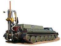
Self-propelled drilling rig UGB-001
Self-propelled drilling rig UGB-001 is designed for drilling geotechnical, geological, hydrogeological and special technical wells in the rocks to XII category drillability. The installation provides drilling vertical and inclined wells.
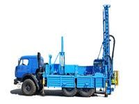
Multipurpose drilling rig PBU-2
Multipurpose drilling rig PBU-2 with driven floating spindle on KAMAZ, designed for drilling geotechnical, seismic, geological, and as well for various purposes during construction works.
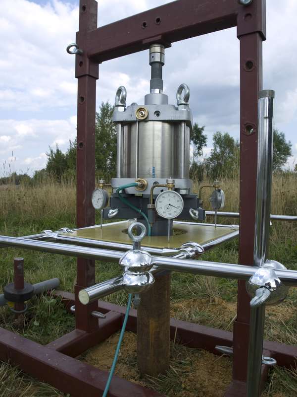
Screw stamp SHV60
Screw stamp SHV60 is (according the classification of GOST 20276-99) type IV and is designed to determine in the field the deformation modulus E, MPa sand, clay, organic-mineral and organic soils in accordance with GOST 20276-99 "Soils. Field methods for determining the strength and deformability. "The area of application is regulated by a screw punch table. 5.1 GOST 20276-99. Modulus of deformation is determined by the results of the vertical step loading the soil at the bottom of excavation, using the stamp. |